Day 51. West Harptree to Stawell

Samaritans Way Day 2.
Distance today: 24.7 miles.
Total distance: 1020.6 miles.
Accommodation: campsite.

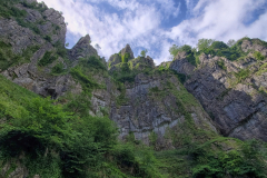
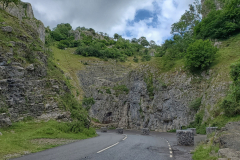
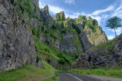
Let’s just get the hills out of the way shall we? A steady 3 and half mile climb and that was pretty much all the ascents finished for the day. I’d temporarily given up attempting to follow my pre-planned route and just made use of Google Maps to find me some convenient roads. Preferably quiet and country. I wondered whether the Romans had spent much time in this area because there were a couple of really long straight roads. In contrast, you also had the winding road through the Cheddar Gorge. I emphasize through because there was a real sense of being insignificantly small compared to the surrounding landscape. I’m sure I must have been through there before but I have absolutely no memory of it. A few climbers looked like they were preparing to scale various cliff faces and it was another one of those rueful moments where I would have liked to have been there with more time and a proper camera. Never mind. I consoled myself with a couple of rounds of very nice (thick!) toast at the busy Edelweiss Café in the centre of Cheddar.

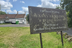
On the outskirts of Blackford, I came across a pub called Sexeys Arms and decided for the name alone, it was worth a pint. I obviously still needed consoling. (… Did I ever mention the time I was in bar called the Sexy Tractor in Lijiang, China? … ). The pub was pretty busy and as ever I probably stood out in all my hiking gear. Bizarrely, I heard someone mention John o’ Groats to Land’s End and I said, yes, that’s what I was doing. I could see a few people having a Sunday roast and as tempting as it was, I resisted. If I am going to have a big meal I do tend to like it if I have finished walking. Unless it’s a Wetherspoons breakfast. When I left the pub, quite a few people wished me well on my trip.

My original route would have taken me through Glastonbury but with the location of available campsites, it didn’t make any sense to do so. Leaving Cheddar I had taken a direct-ish route towards Bridgwater whereas Glastonbury would have meant a bit of dog leg to the east. Nevertheless, at one point I was less than 10 miles away and I was fully aware that the festival was on this weekend. I’d even concocted a scene in my head where I passed a campsite housing people working at the festival and when they heard about my amazing selfless challenge, they offered me a free ticket and accommodation. It didn’t happen.

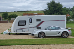
I arrived at The Hideout campsite at around 6pm. Is it possible for somewhere to be too immaculate? It’s nice to have clean facilities but it does spoil the effect a little bit, if you rely on a myriad of warning notices to keep it that way. The site was in a lovely setting but the whole place seemed to be devoid of any character. In spite of there being a number of caravans, the place seemed to be largely devoid of people too. I think I spotted one couple. Jackie, the owner was not on site and had instructed me to post the £18 pitch fee through the letter box. I wonder how many people, like me, ended up putting £20 in because they have no change?

With it being a bit far to walk to find food and drink, I called it a day. At least I did once I’d had my immaculate shower.
Day 52. Stawell to West Bagborough

Samaritans Way Day 3.
Distance today: 18.5 miles.
Total distance: 1039.1 miles.
Accommodation: campsite.

Sometime during the day, I got a text from Jackie, thanking me for my money and suggesting I could pick up my £2 change anytime I was passing. Somewhat cheekily (not to mention, still slightly annoyed), I replied saying that if she liked, she could go to my JustGiving page and make a donation. No reply and no donation.

It took me about 3 hours to walk to Bridgwater along yet more country lanes, passing through the villages of Stawell and Chedzoy along the way. I got caught in a burst of heavy rain on the outskirts of the town but thankfully it didn’t last too long. As I walked over the bridge with the M5 below, it felt strange to cross another motorway. When was the last time? I think it might have been crossing the M6 near Carnforth. Way, way up north.

And so to Bridgwater. Another town another Wetherspoons. There was a lovely moment as I searched for a table that had a nearby power socket. An old guy, I’m guessing in his 80s, asked me what I was looking for. I explained I was on a long walk and I needed somewhere to charge my phone. He asked me where I was going and when I told him John o’ Groats to Lands End he replied: “oh, how far have you got?”. After a moment’s hesitation, trying to process the question and how best to diplomatically respond, I replied “Well, erm, I have got to here.”
After a wander around town, I managed to find a Millets to stock up with a couple of dehydrated meals. With little other reason to hang around, it was time to leave the metropolis and head for the (Quantock) hills. I was still sticking to the roads because, quite frankly, I couldn’t be bothered with the frustration of trying to follow the minor trails. I’m sure I was missing out on some beautiful landscape but at least I was holding onto my sanity.

For the next 9 miles, the road steadily climbed until it reached the top of Lydeard Hill. The surrounding scenery had a gentle pastoral feel to it – there was even a bucolic hold-up as sheep were led down from a field, along the road to a farm (sadly, it was too far away for me to capture on my phone).

From Lydeard Hill, the road descended steeply for a couple of miles on its way to West Bagborough. Ever a man whose glass is half empty, I did a couple of geographical calculations and determined that tomorrow morning I would have the pleasure of climbing back up the hill. My campsite for the night was Quantock Camping and it was a mile or so beyond West Bagborough, before the road joined the A358. First impressions, it looked like a lovely set-up. It was a family-run business and they had a variety of glamping pods, shepherds huts, and even the option of ‘outdoor’ rustic tin shack showers. The dad, who must have been in his 70s, was the only one around at the time I arrived and we had a good chat as he showed me an area where I could pitch. I’d asked him if there was anywhere close where I could buy essentials like milk and beer, and he said he would sort me out. Half an hour later, he returned with a bottle of beer and a 2 litre milk bottle for me to pour enough for a couple of cups of tea. And even though I tried, he wouldn’t take any money for it. Very kind.

A bit later, Karen, the daughter, came to take my money for the pitch. According to her Dad she was an ex-corporate lawyer who’d returned to the business after working out in New York where she’d made a lot of money after renovating a brownstone. I could see that. Anyway, she took my £20 but returned 5 minutes later and handed it back to me, supposedly having deduced – possibly with some help from her Dad – that I was doing my trip for charity. Doubly kind. According to my complicated rules, that meant I would donate the £20 to the cause. Had they not charged me in the first place, that money would have been all mine. Damn my honesty.

One of the outdoor showers I was allowed to use was out of commission but I was told if I wanted the outdoor experience I could use the tin shack attached to one of the currently unoccupied shepherd huts. It definitely had that Australian outback vibe about it.

Day 53. West Bagborough to Minehead

Quantock Way.
Distance today: 23.5 miles.
Total distance: 1062.1 miles.
Accommodation: campsite.

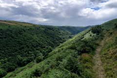
I had a reasonably early start as the plan was to try to get to Minehead. As anticipated, I had to climb back up the hill, leaving the road just before the Rising Sun pub in West Bagborough and then following a bridleway until I was on top of the ridge. I was now on the Quantock Way and I could supposedly follow that all the way to Minehead.

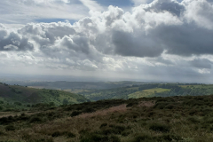
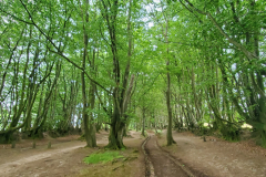
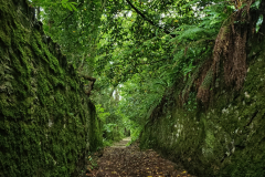
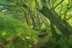
For a while, the undulating trail was mainly wooded. This included an ancient tree-lined track called the Drove Road which was simultaneously beautiful and annoyingly difficult to photograph well. The trail eventually emerged onto more exposed moorland and with no escape from the wind, there was almost a danger of feeling cold. For most of this trip, the weather gods have been very kind to me and so the need to put on more layers did come as a shock.

When anybody signs up for one of these trips, I am sure they become obsessed as I am about mileage. How far have I travelled today? On this trail? In total? What I didn’t appreciate was, as the expression goes, your mileage will vary. MapMyWalk says one thing. Garmin says something else. Google changes its mind depending on whether it is predicting how long a route is or telling you how far you walked based on the plot points you gave it. Bottom line, there appears to be a large margin of error. During the trip, I chose to believe MapMyWalk even if I have since decided it does underestimate. The point is, that somewhere between Bicknoller Post and the top of Beacon Hill, I’d calculated (based on MapMyWalk data) that I had walked 1000 miles. One Thousand Miles. That is just ridiculous, surreal even. It was my second Proclaimers moment. “… and I would roll 500 more“. The next people I met were a group of 3 woman and I felt obliged to share my news. They did their best to sound impressed.

As I headed towards the coast and passed through places like Doniford, Watchet, and Blue Anchor I was back in ‘familiar’ territory again. Well, Penny and I had walked at least some of it before. The route into Minehead takes you along the side of a golf course with the inevitable instructions to stick to the footpath. I had to smile as I compared the paths the golfers got to walk on with the untended, overgrown, mini rollercoaster that the walkers were offered.

It doesn’t take long before you get several, very large reminders that this is a Butlins town. A doff of the cap, Mrs. Lewis. Further on, the other classic elements of a British seaside town come into view: the promenade, the amusement arcades, and the overweight tourists with sunburn.

Before I started the South West Coast Path tomorrow, I really wanted to have a decent guidebook and I’d pretty much decided I wanted the Paddy Dillon one. Knowing that it would be touch and go as to whether I’d arrive before 5pm, I’d rang ahead trying to see who had one in stock. No one. The Information Centre had another book and generously agreed to leave it at the reception of the Beach Hotel which was next door. Before I went there I thought I’d try to see if there was anywhere in the town centre that might have a copy. I’d already rang W.H. Smiths but while I was passing, I thought I’d check for myself. Happily, they had a copy of Paddy Dillon’s book. The woman at the counter apologized that she’d missed it – it had been busy when she looked and so she hadn’t checked thoroughly. Absolutely no problem. I rang the Beach Hotel and somewhat sheepishly said I wouldn’t be picking up the book but please could they pass on my thanks to the people at the Information Centre.

A flapjack shop! That is very niche. Apparently there are 6 in the franchise. Luckily, it was closed.

No surprises, Minehead has a Wetherspoons. I was a few yards away from the front door when I heard some heavy groaning with no idea where it was coming from. It could well have been someone in the throes of passion but it turned out to be a large, old man who had fallen over in the entrance way and until that point, had been ignored. I alerted the bar staff and soon a small crowd of helpers had formed so I left them to it. My work here is done. I had my usual order of a cup of tea but sadly, I could not find a socket to charge my phone. Sat at the next table were a couple who were staying at the Wetherspoons and were clearly not happy. The bloke spent the whole time reading out all the bad reviews he could find on his phone.

After picking up some supplies at the co-op, I headed for the Minehead Camping and Caravanning Club Site. It is not a convenient location. It is one and half miles up a very steep hill. That is not friendly at all, particularly after a long day. To be fair, the reward for being so high up was amazing sea views. Due to Covid, I needed to tell the person who booked me in exactly where I was going to pitch. I thought I’d picked a flat enough spot but decided afterwards it probably wasn’t. It would do.

And my final act (of vandalism) for the day? Taking a pair of scissors to the bits of the guide book I wouldn’t be needing. It felt like sacrilege but there was definitely a weight difference when I was done.

Day 54. Minehead to West Lyn

South West Coast Path Day 1.
Distance today: 25.6 miles.
Total distance: 1088.2 miles.
Accommodation: campsite.

There was a possible shortcut to get to the South West Coast Path without going all the way back into town but ever the completist, I chose to ignore it. I suspect I will only be doing this once so I may as well do it properly. I stopped off at Wetherspoons for tea and porridge and thought I was going to have a repeat performance from yesterday’s whinging couple but thankfully after initially sitting nearby, they moved to a table further away.

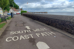
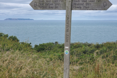
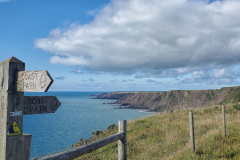
And so to the SWCP. Section 26, my final section. This was a genuine milestone. All the planning, all the dodgy linking routes I’d used to get from one established trail to the next, and it had finally come down to this one last path. Keep the sea on the right and follow the waymarkers. How hard could it be?

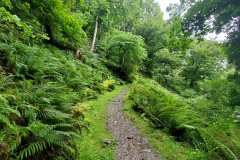
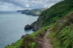
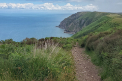
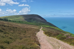
As is traditional, I started the trail with a 5 mile ascent. For the first part, I was walking through what seemed like a sub-tropical forest where the ground was covered in ferns. Further on, the landscape became a more open moorland with a mixture of grass, bracken, heather, and the occasional wild pony. Around this time I bumped into a veritable onslaught of multi-day hikers. 4 to be precise. The young European couple were planning to wild camp the whole trail, a young woman on her own who was seeing how far she could get in a couple of weeks, and the older British guy who was concentrating on giving off a nerdy weirdo vibe. And no, that wasn’t me. I left them to it but we passed each other at various points down the track.

At the top of the hill before the descent to Porlock, the skies suddenly darkened and within seconds, it was hammering down with rain. That was scarily quick and a reminder of just how easily you could get caught out in bad conditions.

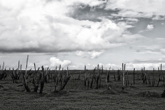
Heading down to Porlock Marsh there were already indicators that however iconic the SWCP may be, the waymarkers were not always going to be clear when there was a choice of multiple paths. The marsh itself was a strange graveyard for an army of blackened tree stumps, poisoned by the salt water apparently. It was certainly an eerie sight. If only had my proper camera, etc. etc.

Once I’d stopped for a coffee and a pasty at Porlock Weir (the gallery having a nice side-line as a café), I had a decision to make. I’d completed the first stage in the guide book so did I stay or carry on? As it was still early enough in the day, I decided to push on. Lynmouth marked the end of the next stage and that was ‘only’ 11 miles away.

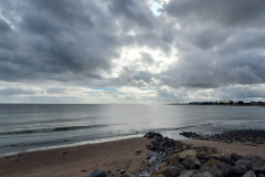
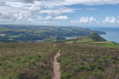
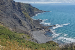
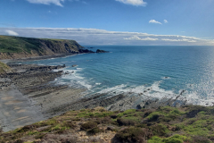
I think there was a bit more hill work in the second leg. Maybe it just felt more because I’d already done the morning shift. The scenery was a similar mix of woodland and moorland with the addition of some paths skirting the cliff tops. Forgive me if I end up saying this many, many times but I do love being by the sea. There is something about the movement of the waves, the ever-changing coastline, and the sheer vastness of it that sooths my soul. I don’t need to be on it or in it, just next to it.

I arrived in Lynmouth around 7pm and treated myself to a large portion of fish and chips. I was going to need the fuel because, guess what, I had booked another campsite a mile up a steep hill. I hate to be pedantic but if you cant guarantee that it is going to be sunny, you shouldn’t be calling yourself Sunny Lyn Holiday Park. Suffice to say, when I reached the site, it was raining heavily and I pitched my tent in record time. Knowing I was going to arrive late, the management had kindly marked my spot with a road cone complete with welcome pack attached. I got chatting with a couple who were also walking part of the trail. I think their names were Catherine and Nigel, cant be sure, but they deserve an honorary mention for the fastest online donation. I’d barely finished speaking to them and I’d got a ping on my phone to confirm they had given £10 which, as I reminded myself, is actually worth £20 due to the fund-match. Thank you both. Eagle-eyed, I’d spotted the Cottage Inn just down the road and it seemed like a good place to shelter from the rain, enjoy a pint, and cheekily – with permission – charge my phone.

Day 55. West Lyn to Ilfracombe

South West Coast Path Day 2.
Distance today: 21.3 miles.
Total distance: 1109.5 miles.
Accommodation: hostel.

My completist principles were put to the test when I was faced with going down to Lynmouth to re-join the SWCP, knowing that I’d then only have to climb back up the same hill somewhere else. Alternatively, I could let common sense (and laziness) prevail and take a shortcut via Lynton that would miss out a small section of the SWCP and, more importantly another steep hill. Let’s just say I was sticking to the spirit of the SWCP rather than the literal path.

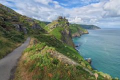
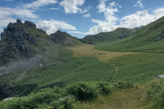
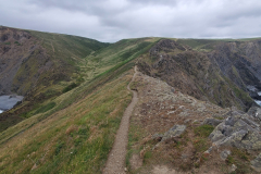
Today was a fantastic day of coastal walking. Okay it might have included over 3000 feet of climbing but that was a small price to pay for some stunning views. Just past Lynton along a tarmac(!) path was the Valley of Rocks. It was a bit of a Hollywood name, or at least a potential B movie. Return to the Valley of Rocks. The rocks in question tended to be quite regular in shape and when stacked on top of each other, they looked like a child’s building blocks, about to tumble over. The whole place had the vague feel of an alien landscape. And, as advertised, there were wild goats, although they weren’t very entertaining. I think they were all lying down in anticipation of the tourist buses. I’ve heard they only like to play to a bigger crowd.

It still amazes me that for something so beautiful, you barely meet a soul on route. Maybe the hills put people off. As ever, there was the moral dilemma of wanting more people to enjoy it but not that many, that they would spoil it. Heading down into Combe Martin, I did bump into Catherine and Nigel (let’s call them that) and they very kindly bought me a coffee at the Redwood café. They’d somehow got ahead of me even though I think I started earlier. I did know that they were using a bag shuttle service to save them having to carry all their gear, something I could see me doing at some point in the future.

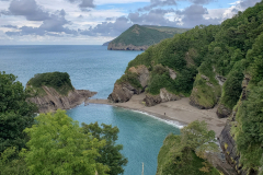
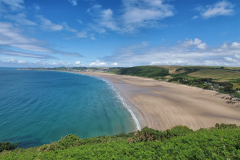
After Combe Martin came the hamlet of Watermouth. It was a pretty area complete with castle, harbour and several camping possibilities. The SWCP passed through the Watermouth Valley Camping Park and it provided a classic example of why I like to stick to the trail where possible. There was an obvious shortcut through the campsite but by staying on the path, I was treated to the view down onto the stunning Broadsands Beach. From my high vantage point, the side where the sea came in was hidden by trees, giving the magical illusion of a tropical lagoon.

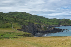
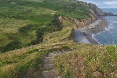
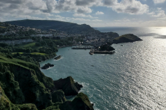
When it came to the daily question of where was I planning to stop for the night, today’s answer was Ilfracombe. It was about the right distance and even though there were no handy campsites in range, it did have a hostel. As I approached what I thought was Ilfracombe, happily thinking my hill walking was done for the day, I soon realised that it was in fact Hele Bay, and the SWCP still had one final evil climb in store. That is unfriendly. Unsurprisingly, this led to a fair amount of swearing. Why oh why? The justification became apparent once I’d climbed out of the woodland and reached the cliff edge. There in front of me was the amazing view of the coast heading down to Ilfracombe harbour. Absolutely beautiful.

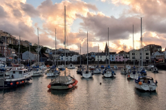
Ocean Backpackers was pretty central to town – central enough to have its own gang of teenage girls sitting on the wall opposite, swearing and shouting. I was sharing the ground floor dorm with a cool older dude (think Sam Elliot in Road House) and a young woman called Grace, both walking the trail – or at least a section of it. After having a bite to eat at the Smugglers restaurant, the final treat for the day was a harbourside wander as the sun went down. I wouldn’t say it was a classic sunset but there was just a lovely atmospheric glow both in the sky and reflected in the water. It had been a good day.

Day 56. Ilfracombe to Braunton

South West Coast Path Day 3.
Distance today: 25.7 miles.
Total distance: 1135.1 miles.
Accommodation: with friends.

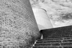
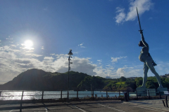
My first task of the day was to struggle to take a photo of the impressively tall Verity statue down at entrance to the harbour. Given that it featured a pregnant woman with part of her body anatomically exposed, I imagined it had caused some controversy when it was first erected. I wasn’t surprised to learn that it was the work of Damien Hirst. And guess what trivia fans? It was made in Stroud. I imagine the Landmark Theatre also had its fair share of naysayers. It had a little bit of an unforgiving cooling tower aesthetic, but I liked it.

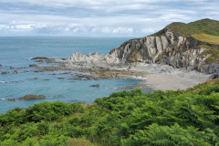
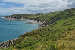
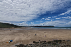
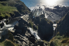
The coast between Ilfracombe and Mortehoe was particularly beautiful with long sweeping views and a classic palate of greens and golds set against the silvery grey of the jagged cliff faces. I’m not exactly sure what happened when I reached Mortehoe because I think the SWCP is meant to stick close to the coast but the waymarkers took me on a completely pointless inland detour (in my humble opinion) before returning to the coast again. Next stop, the fantastic expanse of sandy beach that is Woolacombe. It was here that I had arranged to meet my mate Steve. He and Helen lived in Braunton and so this was just one of their local beaches. It’s very easy to understand the move down from Bristol now. Steve had suggested we meet at the Porthole café which was in a lovely spot halfway along the beach. And the food was good too. Steve treated me to one of their salad boxes which contained 3 different salads. After a mixed diet of, quite frankly, a lot of rubbish food over the last 8 weeks, there was something nourishing about tucking into a healthy meal for a change. Steve and accompanying dog (whippet?) were up for a walk so we followed the coast around to Baggy Point and then on to Croyde. It was really good to catch up, not to mention have my own personal local guide, armed with a random selection of facts and figures. Once we reached Croyde, Steve headed back to pick up his car and I carried on, via a very circuitous route, to Braunton. Needless to say, being a completist came at a cost. By trying to stick to the SWCP, I think I added an extra 5 miles.

My reward for a long day’s walk was a bed, shower, laundry service, delicious dal, and a lovely evening chatting with Steve and Helen over a couple of beers. Having polished off one substantial portion of dal, I uncharacteristically found it very easy to forgo all politeness and dived straight in when asked if I would like any more. Fuel! Give me fuel! Another good day.

Day 57. Braunton to Yelland

South West Coast Path Day 4.
Distance today: 13 miles.
Total distance: 1148.2 miles.
Accommodation: campsite.

A very civilized start to the day with a fine breakfast at The Worx café. Sat at the next table (with his mum, who Helen knew) was a proper fund-raising hero. Max Woosey was The Boy In The Tent who had slept in a tent for 3 years and had raised … wait for it … a whopping £640,000 for the local hospice. Respect.

The civilized approach to things continued with Steve, Helen (and dog) joining me on the section of the SWCP from Braunton to Barnstaple. The trail followed an old railway line and was (a little bit too) popular with cyclists. Nice views of the River Taw. After a coffee and cake in Barnstaple, it was time to say goodbye. It had been a flying visit but I definitely felt a tinge of sadness heading back on to the trail. I think it emphasized if not the loneliness then the solitude of what I was doing.

As if to confirm it was back to business as usual, I struggled to find my way out of Barnstaple – but at least I am now familiar with the local retail park. The trail continued with more (slightly dull) cycle path although Fremington Quay did help break up the monotony even if the café had nothing I fancied.

Treating myself to a short walking day, my stopping point for the night was Yelland. Tarka Trail Camping was a nice, open farm campsite with plenty of space. As a bonus, it also had an on-site brewery/pizzeria. Well, it did in theory. The owner/operator/brewer/chef had gone AWOL. After a lengthy delay, he did finally turn up and I joined 2 other customers as he led the way into the shack/bar/brewery. Let’s get one thing out of the way to start with. Something about the guy was definitely off-kilter. You got the sense that he was a very intelligent man who might have a suffered a serious breakdown at some point in his life. He spotted that I also had a Tilley hat and was disappointed to learn I didn’t keep any money in the (not-so) secret compartment. And as for his brewing skills? I’d say the beer was a little bit home brew-ish but drinkable. In the seating area outside the bar there were faded signs advertising “Pizza £6.99. Any size”. It seemed doubtful but I ordered one anyway. When it arrived, it was about the size and shape of an A3 piece of paper. Huge. Should I have eaten it all? No. Did I eat it all? Yes. The bill for beer and pizza came to £10.

Day 58. Yelland to Clovelly Cross

South West Coast Path Day 5.
Distance today: 27.3 miles.
Total distance: 1175.5 miles.
Accommodation: campsite.

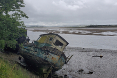
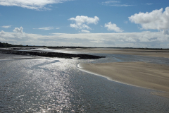
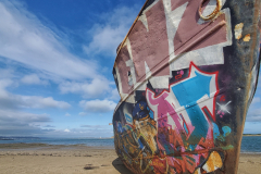
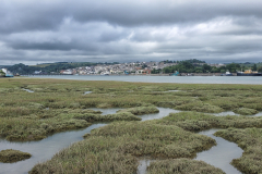
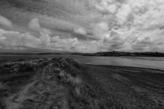
A long day but with enough variety to keep it interesting. There was a nice photo opportunity when the route passed closed to the shoreline of the River Taw. A couple of boats – presumably trawlers – looked like they had become grounded and subsequently abandoned. Graffiti artists had seized the opportunity to use one of the hulls as a canvas. Better there than my tent.

Helen had recommended the food at Johns Of Instow so I stopped there for some breakfast. I think she had warned me it was a bit pricey and you could get a sense of that just walking around the place. What the heck. I did agree with their philosophy about cake.

Were I not a person with strong moral fibre, I could have caught a ferry to cross the short stretch of the River Torridge which separated Instow from Appledore. Instead, the SWCP takes you all the way to Bideford to cross the bridge there before following the river back on the other side. What’s an additional 6 miles when you’re already doing 20?

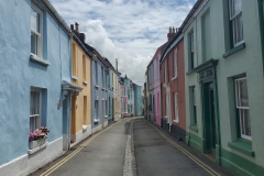
Appledore looked like a lovely little village. The rows of brightly painted houses were very eye-catching, making me wonder what percentage of them were either second homes or Airbnbs? During this trip, accommodation (or the lack of it) had become a pre-occupation but I hated to think that the heart of the village had been ripped out by a mix of desperation and greed.

Once again, the SWCP proved annoyingly true to the idea of a coast path. Why go direct from Watertown to Westward Ho! when you could take a more leisurely route, skirting the edge of the mud flats and then wandering along the beach? Why indeed. Despite my crankiness, I did not regret the extra foot work. Thankfully, it’s very rare when I cannot appreciate a view where the land meets the sea.

I’m not sure I fully appreciated Westward Ho! but judging by the crowds, it was easy to assume a lot of other people did. I stayed long enough to pick up some supplies and then I was back to my more familiar cliff-top walking. And relax.

I’d struggled to find a campsite and ended up choosing Roey’s Retreat Campsite at Clovelly Cross. It was about a mile and half inland from Clovelly which was where the SWCP passed through. More significantly, it was at the top of a steep hill. On the approach to Clovelly, the SWCP followed The Hobby Drive which under normal circumstances made for a pleasant woodland walk. However, it was already past 7pm and I realised that the further I followed the trail, the further away I was going from the campsite and the more hill I would then have to climb. I made an executive decision to abandon the trail and go cross-country, the aim being to join the A39 in as direct a route as I could find which ended up being across a couple of fields and along a farm drive. My destination was then less than a mile up the road.

The campsite had only been open for about a month and I think the couple who ran it had a farm somewhere nearby. When they came to do their rounds, I bought a can of cider off them. They seemed keen to quiz me on what kinds of food and drink would go down well with walkers. He suggested bags of stew (!) while she thought they could perhaps sell a couple of slices of bread rather than a whole loaf. My personal theory? You can’t go wrong with beer, pizza, and cake.

Day 59. Clovelly Cross to Mead

South West Coast Path Day 6.
Distance today: 20 miles.
Total distance: 1195.5 miles.
Accommodation: with friends of friends (in a caravan).

Walking down the hill to Clovelly I bumped into a young guy who was also doing the trail. I think he’d stayed at the campsite too. We arrived at the visitor centre about half an hour before it opened and the dilemma was to stay to get some food at the café or to march on an empty stomach. He stayed, I left. I had 2 further decisions to make. Did I go back and do the mile and a half of SWCP I’d missed by taking last night’s shortcut and did I take a short scenic detour to visit the quirky car-free Clovelly village. No to both. I guess I just wanted to get on with it.

Speaking of getting on with it, not far along the track I met someone who was doing the LEJOG. I think he was South African and I can’t remember the charity he was doing it for but I know he hoped to complete it in 40 days after committing to walking at least a marathon a day. That’s not messing about. Good luck to him.

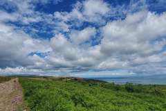
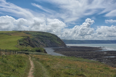
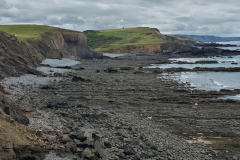
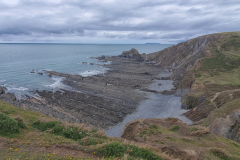
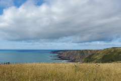
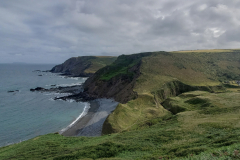
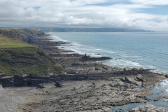
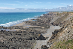
There was a lot of cliff-top walking today with the occasional lighthouse and radar detection station thrown in. Not to mention Lundy which always seemed to be there in the distant background. Around most corners there was usually something different if not spectacular.

I reached Hartland Quay at around 3.30 and although the pub was open, I’d missed the time when they were serving food. Strangely, they did have flapjacks. A cup of tea and a flapjack it is then.

As if Steve and Helen had not been kind enough already, they’d put me in touch with friends of theirs who had offered to give me a bed for the night if the timing was right when I was passing. Bek and Steve lived near Welcombe, a mile inland from Welcombe Mouth Beach. Once I’d left the SWCP, I cut through some fields until I reached the road they were meant to be on. I was doing my best impression of a lost tourist when Bek pulled up in her car, having guessed who I was. After first apologizing that she had to go out for the evening she then pointed me in the right direction.

Berry Park was a large Victorian house which a group of people had bought to divide up and use for co-housing. That plus the 6 acres of land it came with now formed the basis of the Berry Park Project which was essentially an attempt to create a community which cared for each other, their surroundings, and the planet. It was both a noble and a pragmatic endeavor, allowing people to live in a beautiful place which, as individual families, they had no chance of affording. I’ll be honest, it scared me to think of living cheek by jowl like that. I liked the community-spirited idea in principle but I’d be the first to recognize that my kind of whinging personality probably would not be a good fit. I think I’d just end up being annoyed all the time. After a lovely home-cooked meal, Steve showed me around the grounds. It was still early days but there were grand plans afoot. A lot of emphasis was being placed on nurturing a low-impact self-sustaining lifestyle. It is easy to be wary of the potential happy-clappy nature of these kinds of enterprises but you sensed that, in their case, there was the right mix of creative and artisan skillsets that could keep the whole thing much more down to earth and practical. And fun.

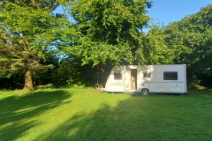
In more mundane matters, I was given the choice of whether I wanted to pitch my tent or make use of the guest caravan. Who could refuse the luxury of a night in a caravan.

Day 60. Mead to Widemouth Bay

South West Coast Path Day 7.
Distance today: 17.3 miles.
Total distance: 1212.9 miles.
Accommodation: campsite.

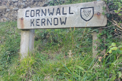
After being the beneficiary of an amazing generosity of spirit yesterday, I was back in my role as the lonesome walker. Less than half a mile from where I joined the SWCP, I crossed over into Cornwall. My final county. As I noted in my Instagram post, it was a long way from Caithness.

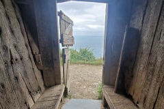
A few miles further on and tucked away on a ledge just below the top of the cliff was Hawker’s Hut. As much as I liked the idea of it originally being used by an opium-smoking vicar, it was its life since then that interested me. You could easily imagine that generations of walkers had taken temporary refuge there and while they waited for the weather to clear, they’d got out their swiss army knives and carved their initials into the well-worn wooden benches. I don’t think I saw a single bit of graffiti that had been scribbled or sprayed which somehow made it quaintly endearing. This was ramblers living life on the edge.

Not far from Hawker’s Hut was Higher Sharpnose Point. It was a headland that jutted out a couple of hundred yards out to sea and provided an odd perspective when you looked back to the coastline. Separate seas lapping up on separate shores.

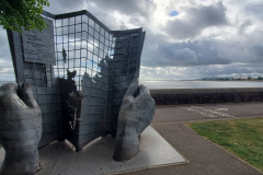
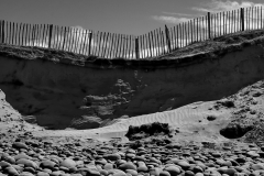
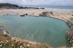
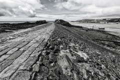
Once I’d passed GCHQ Bude with its slightly optimistic signs discouraging photographs (given that the SWCP passed right by it), the next main stop was Bude itself. As ever when I reached a metropolis, I didn’t hang around long but, on first impressions, it looked quite nice in an old-school seaside town kind of way. It definitely gets bonus points for the Sea Pool which almost had me stripping off. The breakwater was also worth (an arty black and white) photo. Once I’d stopped off for supplies at Sainsbury’s and done my mini tour, I was on my way again.

On the way to Widemouth Bay, I stopped for a chat with a couple sat on a bench. Other than discussing the stunning coastal views and my amazing challenge, obviously, the main topic of conversation was whether the business opposite (Elements Hotel) had burned down by accident or as part of an insurance scam. It looked very suspicious to me.

If you were looking for a place to stay, you could do worse than Barford Beach House. Sleeps 12, has its own private beach and is very handily right on the SWCP. It will only set you back about £4500 for 4 nights. I think I’d need more friends. A few hundred yards up the hill and slightly more modestly priced at £15 a night was Penhalt Farm campsite. It was fairly basic (i.e. it didn’t have a shop or a bar) but the views were panoramic and there was plenty of room to pitch. I even managed to get a beer from a couple staying in a campervan. 2 young women arrived late and pitched not far in front of me, dangerously risking messing with my view. They had the look of people who were going to be drinking into the early hours (i.e. happy) but were thankfully quiet. As was the rest of the campsite.