Day 61. Widemouth Bay to Trethevy

South West Coast Path Day 8.
Distance today: 17.5 miles.
Total distance: 1230.3 miles.
Accommodation: campsite.

Another lovely day on the coastal path. Apart from the steps. I still hate steps. I’ve almost certainly got fitter during this trip but for whatever reason, steps never seem to get any easier. Going up, the legs have to be lifted slightly higher than they would comfortably want to go. Coming down, I found the impact on my feet very jarring when they landed on the step below. And as a bonus, the effect In both directions was exaggerated because I was carrying a big pack. I’m not sure if my legs would have made it this far if I hadn’t had my trekking poles.

Most of the day seemed to be spent walking on or at least near to cliff tops. The coastline remained rugged and craggy while inland was the usual mix of bracken, gorse, and grassland with the occasional grazing sheep. I loved the sense of being in a big open space. All in all, it was fine way to go from A to B. I stopped off at Crackington Beach and had a coffee and a pasty in the Cabin Café. Sam Elliot was there too although we didn’t go as far as having an actual conversation.

One of the highlights of the day was undoubtedly Boscastle. The village was charming enough but in terms of out and out drama, it was the harbour that had the wow factor. It looked like it belonged in a Hollywood film – a romcom where the protagonist is a Cornish fisherman. Rather that than the disaster movie of 2004. After a coffee at the National Trust café and picking up some supplies (scones, cider, and more pasties) in the village, I was on my way again. I will be back.

Three miles further on from Boscastle, my stopping point for the night was the Trewethett Farm Club Campsite near Trethevy. It was a big sprawling site home to mainly caravans and campervans and while it might have lacked a little charm, it made up for it in terms of location. It was barely a few yards from the SWCP and having picked a front row pitch, the view from my tent was directly out to sea. Simply gorgeous.

Day 62. Trethevy to Polzeath

South West Coast Path Day 9.
Distance today: 24.1 miles.
Total distance: 1254.4 miles.
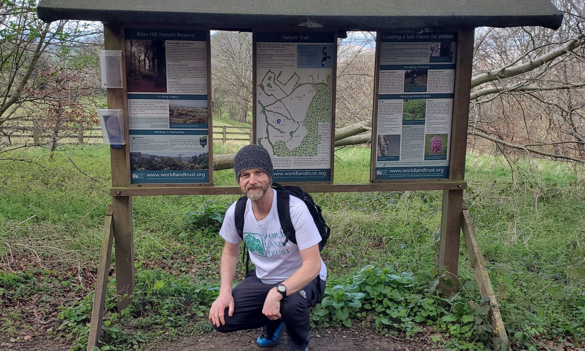
Accommodation: wild camping (in a garden).

In case anybody was in any doubt, let me make it quite clear. This is a stunning stretch of coastline to walk along. Easily some of the most enjoyable parts of my trip so far. Don’t be put off by those people who say it’s really tough. Take it slow, stop to admire the views, and be thankful that such a thing exists, in our country, and is open to all. Free! That’s a miracle in itself.

As if to confirm its status as a path of distinction (an award I just bestowed upon it), within a couple of miles of the campsite, the SWCP brings you to Tintagel Castle. Or more specifically, to a view of the castle and the bridge that linked it to the mainland. The combination of all the elements that nature can provide together with man’s perilous ingenuity was unbelievably spectacular. I think the ancients picked a good spot for a fortification.

A couple of miles further on and I reached Trebarwith Beach. It was a nice little cove but it was fair to say I was more distracted by the steep climb I faced to get beyond it. I stopped to refuel at The Strand Café which had a cool surfer shack vibe to it. Reading ahead about what I had to look forward to on the trail, I had discovered to my amazement that the official SWCP recommendation was to catch a ferry from Rock to Padstow! How does that qualify as a bona fide coastal route? I asked the owner of the café if he knew what the alternatives were. At one point he (half) jokingly offered to get in touch with a mate who could paddle board me across the river. Sadly, I think that still counts as transport. As I was leaving, a customer who had obviously been listening to our conversation, came up and as well as wishing me luck, offered me the book he had just finished reading: Travels With Charley by John Steinbeck. It was a touching gesture and very appropriate given its apparent wanderlust themes. Reluctantly I declined on the basis of weight (not that the paperback was that heavy) and, perhaps more significantly, the fact that I was unlikely to give myself the time to read it. Most evenings when I finished walking, I was pretty much good for nothing other than eating and drinking.

The next interesting distraction on the trail was the village of Port Isaac. With its chocolate box cuteness, it was another place worthy of being a film backdrop. Clearly given Doc Martin, Saving Grace, and various other productions, I wasn’t the first to think of this.

Not to be outdone in terms of sheer idyllic beauty, was the neighbouring hamlet of Port Quin. It was absolutely picture perfect. Not a hint of fluorescent clothing or a brightly-coloured beer garden umbrella to be seen anywhere. Ignoring the occasional telegraph pole, if you were looking on from a distance, you could genuinely struggle to work out what period in history you were in.

It was now around 6pm and I needed to work out where I was going to sleep. The nearest campsites were close to Polzeath which was still a hike away. I’d rang a couple of sites and they were either full, didn’t cater for tents, or simply weren’t prepared to either book me in over the phone or wait until I arrived. And this was in spite of my best I’m-doing-this-for-charity pleading. Oh well, it looked like I was wild camping again. I started to keep my eye open for suitable spots but as I knew I probably wouldn’t pitch my tent until it got dark, I decided that unless I found the perfect spot, I may as well keep making progress until it was nearly dark.

Not far from Polzeath were the twin headlands known as The Rumps. It was the site of an Iron Age fort although you might have to be an archeologist to detect any evidence. Not that it mattered (to me) because with the sun on its way down, the place had a magical aura to it. I even thought I’d found a discreet place to camp when just at that moment I could see a group of men heading in my general direction, armed with beers and fishing rods. Maybe not then. Frustratingly as I headed away from the Rumps, I just couldn’t find anywhere that seemed tucked away (enough). Arriving in Polzeath, my consolation for still being homeless was the beautiful sight of the sea and the beach catching the last bit of light before the sun finally set.

Polzeath appeared to be a strange mix of old housing stock and spangly new upmarket homes. You got the sense that whenever a tired old dwelling came on the market, it would be bulldozed and replaced with something shinier and almost certainly bigger. It made me wonder how many locals looking to buy could keep up with the scarily high house prices? Meanwhile, I was still looking for somewhere to sleep. The Tristram Caravan Park was tantalizingly convenient but it was way past office hours and I think they didn’t allow tents so I would have looked fairly conspicuous if I had tried to sneak in. I resigned myself to heading further along the trail.

As the route changed from village to more open countryside, I saw a woman sat in the garden of the very last house. With nothing to lose, I shouted across to her. “Excuse me, I don’t suppose you have anywhere where I can pitch a tent do you?”. Sadly, she didn’t. I got the feeling she was wavering but it wasn’t her house so it wasn’t her call to make. I totally understood and respected her decision. Did she know of anywhere nearby? She pointed to a spot all of 30 yards away, just up from the beach, and said she’d seen people camp there before. After thanking her, I went to check it out and decided it was a bit open with a good chance of being disturbed by drunks walking back home, but it would do. It was still a bit early and so I started to rearrange my bag to allow quick access to tent, mattress, and sleeping bag. At this point, the woman from the house came over and half-apologizing, explained that the house belonged to her family and she could make the decision but I needed to convince her that I wasn’t an axe murderer. Well, what do you want to know? I’m walking from John o’ Groats to Land’s End for charity – see, this is my card. I have a website! I live in Stroud with my partner Penny and our cat Lilly … I think I passed the audition although I’m sure that part of the deal of being a successful axe murderer is to have a credible backstory.

My host’s name was Vanessa and she said I could pitch my tent on the level patch of grass in front of the house. I think someone with a good arm could throw a stone and it would hit the Atlantic Ocean. Absolutely amazing. And the final act of kindness? Vanessa managed to find me a beer and then raided the fridge to produce a meal out of what was left in there. The spirit of generosity lives on.

Day 63. Polzeath to Padstow

South West Coast Path Day 10.
Distance today: 16.3 miles.
Total distance: 1270.7 miles.
Accommodation: campsite.

There have been many memorable views on this trip but as I headed towards Rock just after 7 o’clock, the view across the river was absolutely breathtaking. The photos definitely don’t do justice to the incredible morning glow which seemed to envelop the landscape, picking out all the pastel shades of the water and the sand and the fields and the sky. I was literally stopped in my tracks, incapable of doing anything other than saying ‘wow’. A lot. An amazing, humbling experience. No wonder people are prepared to pay a lot to live around here.

Less amazing was having to stick to my strict no-transport policy. Instead of catching the ferry from Rock to Padstow as per the official SWCP recommendation, I was walking a 12 mile detour to get to the nearest bridge. Whose stupid rule is this anyway? For the next 6 miles up to Wadebridge, I cobbled together a route along quiet country lanes, the occasional field, and when there was no alternative, annoyingly busy roads full of holidaymakers in a hurry to get to their destination. There were at least a couple of occasions when the map said there was a footpath and the farmer had decided otherwise. On route, I passed a few seriously expensive looking designer-houses, including Waterhouse which was a snip at £3,500,000. For some reason there were lots of pesky flies around and as it was hot enough for me to need sun tan lotion, I successfully managed to glue squadrons of the little blighters to my arms. That’ll teach ’em.

When I reached Wadebridge I stopped for a late breakfast and then picked up a few supplies including various ointments, plasters, and dressings to help my feet stay in working order. At some point on the trip, the soles of my feet had started to get very tender. The good news was that today was going to be a lazy sub 20 mile day as I planned to stop at Padstow.

The route from Wadebridge to Padstow was along the easy but mostly dull cycle path known as the Camel Trail. I’m sure it was fun if you were a cyclist. Perhaps not for the woman I encountered who had fallen off her bike and was left with a nasty cut on her leg. Cometh the hour, cometh the man who’d just bought a whole load of first aid kit that might be useful in a situation like this. Once she was patched up, the group she was with were trying to convince her that she’d be fine to continue. I don’t think she was so sure. I left them to it. My work here was done.

The Foreshore (Dennis Farm) campsite was on the near side of Padstow, right next to the trail, with a great view looking over the estuary. Should you want to have a bit more space, their other site was just a couple of hundred yards away. It looked like I’d caught up with Sam Elliot again. How come he is always ahead of me?

You had to traipse uphill to book in and your reward was having the cheeky bloke on reception take the piss out of you. “I love multi-day hikers. You’re all so weird, aren’t you?”. I’m not sure how you’re meant to respond to that. Later on, one of the other people working there came round with free food. Cheese, bread, fruit, wine … Apparently, lots of people in caravans and campervans couldn’t be bothered to take it home with them.

In the evening I went for a wander into Padstow. Welcome to Rick Stein Town. He was everywhere. There was a café; a fish and chip shop (complete with very long queue); a restaurant; and, my favourite, a homeware shop! Really? I’ll be honest. I struggled to fall in love with the town. It just seemed to be lacking some charm. Apart from being annoyingly difficult to photograph, the harbour felt more like a functional holding bay rather than a place where they’d be singing sea shanties. Treated myself to a pizza and a pint of Proper Job at the Shipwrights pub and then called it a night.

Day 64. Padstow to Bedruthan Steps

South West Coast Path Day 11.
Distance today: 20.9 miles.
Total distance: 1291.6 miles.
Accommodation: campsite.

Another beautiful summer’s day walking the trail. Maybe that’s all I need to write. If you look at the photos, I think you’ll get the idea. Very, very special. As with yesterday, the reward for being up early (apart from having the place to myself) was the light. There’s a softness to it but it also feels like a hint or even a promise of what’s to come. And since when did estuary beaches have golden sand? That’s it, I’m moving down here.

Beyond Padstow, I made my way past places like St George’s Cove, Harbour Cove, Hawker’s Cove, Stepper Point, and Trevone Bay. Beautiful beaches nestled amidst rugged coast line. Just beyond Trevone I got chatting to a couple and the woman was gently mocking the man who seemed to be a mine of interesting facts. One of them was the exact halfway point between John o’ Groats and Land’s End (as the crow flies). Any guesses? It is actually the Isle Of Man. I did not know that. They promised to make a donation and indeed, when I checked later they had given £30! So a big thanks to Sally Wilcox and partner.

It was about 11 o’clock by the time I reached Harlyn Bay and the beaches were starting to fill up. The nearby Holiday Parks undoubtedly helped swell the numbers. Suspecting the café at the beach was going to be more expensive, I thought I’d wander into the village to find a cheaper alternative. After a fruitless loop I was back at the beach and reluctantly queuing up at the Beach Box Café for a coffee. Given how hot it was, I probably should have been hydrating rather than caffeinating.

Beyond Harlyn, the SWCP skirted the coast, passing the holiday parks on its way to Trevose. There at the end of the bay was the incredibly iconic RNLI Padstow Lifeboat Station. What an amazing looking building that is. Another one for the proper camera.

On past Bays Constance & Treyarnon, and Coves Wine, Pepper, Warren, Fox, Rowan, & Long. Approaching Porthcothan, I passed a group of cheery women setting up camp in the Porthcothan Clifftop Camping site just over the fence. “Would you like a beer?” one of them asked. Yes, I would. They all worked in Newquay and were very much enjoying their day off.

My own choice for campsite was a couple of miles on from Porthcothan at Bedruthan Steps. It was a fantastic cliff-top location. I could tell straight away that this was my kind of place. It had a definite ramshackle off-grid Glastonbury vibe to it. The young team staffing the site were all sat outside the reception caravan, busy in conversation but equally happy to greet new customers. At gunpoint I was forced to tell everyone about what I was doing and I think they were suitably impressed. So much so that one of them (Kate I think her name was) was doing a run to the shops and asked me what she could get me. Beer? She later delivered 2 cans of beer and refused to take any money for them. It was much appreciated. I appear to be drinking for free today.

For some reason I decided to pitch my tent near the fence next to the road. I think it may have been because I hoped it would slightly quieter with less people camped there. That was the theory. Half an hour later I was perhaps regretting my decision. A black Audi cabriolet pulled up next to me and out-stepped the angriest camper I have ever met, followed by his understandably cowed girlfriend. It genuinely looked like his head was going to explode at any minute. I think I detected a London/Essex accent and by all accounts he had done a lot of camping whereas his girlfriend was a novice and was consequently getting a lot of flak for doing everything wrong and saying anything that remotely sounded like she was complaining. I mentioned my walk and his response was that he could do that. “It’s all up here”, he said, stabbing his finger against the side of his head.

Food-wise, the good news was that I had picked a night when Fat Jack’s Shack was on site. At £10 for a burger I thought it was a bit steep but it came with a healthy portion of potato salad and I am here to tell you it was the best burger I have had in a very long time. And somehow I appear to have been caught loitering by the on-site social media updater.

I mentioned Angry Audi Man to the camp site crew and they agreed, he did look like an unlikely camping enthusiast. Concerned that I wasn’t going to be able to sleep, Kate very generously offered me the use of one of the tipis in the next field. I nobly declined, figuring everything was probably going to quieten down. And it did.

Day 65. Bedruthan Steps to Holywell

South West Coast Path Day 12.
Distance today: 18.5 miles.
Total distance: 1310.1 miles.
Accommodation: campsite.

When I first got out of my tent, Angry Audi Man was already up, polishing his car.

On the trail by 7.30 and even that early it felt like it was going to be another hot one. The beaches and the cliff-top walking were as lovely as ever and when I reached Watergate Bay it was interesting to see that they had at least made some effort to blend in the more recent holiday property development into the surroundings.

I reached Newquay by about 10.30 and inevitably tracked down the Wetherspoons to get some breakfast and charge my phone. The bad news was that my ‘quick charge’ was no longer working. I think I must have bounced my phone one too many times. I cant remember the last time either my phone or my power block were fully charged. With so much time spent on my own in relatively unpopulated surroundings, it was always a bit of a culture shock when I did pass through a busy town. Maybe I am doing Newquay a disservice but it had a cheap ‘n’ cheerful feel to it.

Once I’d stocked up on snacks, my next challenge was to get across the River Gannel. It all depended on the tide. At low tide, you could cross using the Penpol foot Bridge and so I optimistically headed in that direction even though I could see the tide was starting to come in. Checking with some people who were walking the other way, they confirmed I was too late. The bridge was already under water. Still determined I could beat the system, I looked for other ‘unofficial’ places to cross but finally admitted defeat and used the bridge further inland. Even once I had crossed over, I barely managed to get onto higher ground before the access was blocked by the incoming water. Tide waits for no man.

Looking down on to the busy looking Crantock Beach from the SWCP, I couldn’t help thinking of Martin Parr’s iconic seaside photos. It was a patchwork quilt of wind breaks, umbrellas, chairs, towels, tents, and swimming costumes. There just seemed something very nostalgically British about it.

Continuing around the coast, I stopped for a coffee at the slightly upmarket C-Bay Bar & Bistro. I think I successfully managed to lower the tone of the place. Nice views across the bay.

Did I mention that it was hot? When I got to Holywell Bay at around 5.30, I was definitely flagging. I’d been looking online for a campsite but I’d struggled to find anything that wasn’t either a traditional holiday park or caravans and campervans only. I went to ask in the Gull Rocks Bar to see if they knew of anywhere nearby. I will credit them with giving me a name. I will also name-and-shame them for going to the effort of having a sign made up that stated “We do not refill water bottles so please do not ask“. Given that they are next to both the beach and the SWCP and it is the height of summer, what kind of mean-spirited fuck-you policy is that? It is almost bordering on being irresponsible.

And so to the campsite.

Picture the scene. A tired walker arrives at a coastal resort having spent all day walking (for charity) in muggy heat. It’s 5.30pm and ideally he wants a campsite and a shower rather than having to carry on looking for a wild camping spot. After being given the name, he finds the Parkdean holiday park (remember Grannie’s Heilan’ Hame) and yes, they have a pitch available. The woman on reception appears to be new and spends 10 minutes struggling to put his details in the system and then she finally tells him the price. FORTY SEVEN POUNDS! That has to be a mistake, he says. Can you check with your colleague? And her colleague confirms yes, that was the price. It’s high season. No view, no phone signal, nowhere to charge a phone, no free bar, no champagne breakfast. More than 4 times the price of the campsites he went to before and after. Scandalous. To his shame he still took it.

I get it. It’s a big organisation, there’s no room for flexibility and to a large degree it doesn’t matter to them if the pitch is taken up by 1 person in a small tent or 4 people in a campervan. I get it but it is still mean-spirited. And it is still basically saying: walkers not welcome.

With very little charge left on my phone, I was forced to have a couple of pints in the bar, sitting next to a socket, while all the Parkdean resorts linked up for a game of bingo and then, happily out of sight around the corner, our local Redcoat compered some audience participation styled entertainment. Fun for all the family. And yes, I was still fuming.

Day 66. Holywell to Coombe

South West Coast Path Day 13.
Distance today: 23.5 miles.
Total distance: 1333.6 miles.
Accommodation: campsite.

All my fretting over accommodation was put in perspective when I bumped into someone wild camping for the whole of the SWCP. I don’t think he was in any hurry and he currently had a spot perched high above one end of Perran Sands Beach. It seems that we multi-day hikers all like our rules and his was that he had a total daily budget of £10. He was at pains to point out he could afford more but that was his challenge. While we were chatting, a pompous sounding farmer came along, walking his dog. There then followed a you-people type conversation where the farmer accused hikers of trashing the beach and using it as a toilet. My new colleague gave as good as he got, returning the accusation that it was generally the dog walkers that didn’t clean up after their dogs had used the beach as a toilet. I think it was almost an amicable argument. By the way, Perran Sands was a beautiful, long beach. Picture perfect.

What do we want? Breakfast and a phone charge. When do we want it? When we get to the Wetherspoons in Perranporth. It was slightly longer stay than usual to give my phone a fighting chance of lasting the day. Incidentally, for anyone who received our Protect What You Love Christmas card, Perranporth was where I saw the mural.

It might be my imagination but I’m sure the sea was taking on a more of an aquamarine colour than it had up until now. From the high vantage point of the cliff tops it just looked stunning. One day I might have to take a dip.

Somewhere between Perranporth and St Agnes, the serenity of the trail was tested by the background presence of what sounded like either motorbikes or quad bikes going around a track. It was quite a distance away but one of the side effects was the kicking up of large dust clouds that carried all the way down to the trail. I was surprised that whatever it was had managed to get a license. I suspect there are more bikers than there are walkers.

I trawled the shops in Portreath to try and find something to eat. The best I could find was a pack of 4 strawberry muller rice. I ate 2 of them straight away. I suspect that is not a healthy diet. I’d walked a couple of hundred yards down the road before I realised I’d left my walking poles in the shop. My diet was clearly already affecting my brain.

My stopping point for the night was the Magor Farm Campsite, about a kilometre in land from the SWCP in Coombe. Just where I turned off from the trail, there was a lovely viewpoint and a couple were gazing out over the shimmering sea, enjoying a beer. That is not a bad way to spend a late afternoon.

With a little bit of help from 2 dog walkers who bore a striking resemblance to the Hairy Bikers, I found the campsite and it was fairly basic but in a nice location, completely surrounded by trees. I found a place to pitch and then immediately lay down, head against my backpack. It had been another long hot day. Looking around, there seemed to be a large group of people who all knew each other. Someone from the group came over and asked if I needed anything. Tea? Coffee? A cup of tea would be lovely. Later on they came back and asked if I wanted anything to eat – they could do me some cheese on toast. It was a really kind gesture which I graciously declined.

The owner came by later, driving around the site in her car, picking up pitch fees. You got the sense that there were lots of regulars and she knew everyone. I spent the rest of the evening waiting for one of the few power sockets to become free (in the laundry) and then risked leaving my power block plugged in overnight.

Day 67. Coombe to St Ives

South West Coast Path Day 14.
Distance today: 20.4 miles.
Total distance: 1354.1 miles.
Accommodation: campsite.

I’d set my sights on ending the day in St Ives. I think I’d only been there a couple of times before but there was some arty fanciness to it which made a nice change from your typical seaside town – as long as you didn’t mind fighting your way through the crowds. Between me and there were the usual complement of cliff tops and beaches.

The first main landmark was Godrevy Point with Godrevy Lighthouse just a short way out to sea. What is it about lighthouses that makes them so … likeable? Do we find them reassuring? Are they simply a nostalgic link to the past? Is it the drama of them being out in all weathers, amidst the crashing waves? Or is it just the child-like simplicity of their iconic shape? I don’t know, I just like them. That said, this one was particularly annoying from a photography point of view. I struggled to take an interesting shot because I am incompetent there was very little around it to give it any context. Whose idea was it to put it on an island?

From Godrevy to Hayle, the trail followed what was essentially one long beach. Actually, strictly speaking, the SWCP ran parallel to the beach but I was content to walk along the sand. At one point, I passed a woman walking a dog and I’ve never seen a dog so excited about going in the sea. It would look at its owner, as if waiting for permission and when it got it, it would jump headlong into the waves. Again and again. It was a lovely, joyous thing to watch.

The River Hayle provided an inconvenient obstacle preventing me from getting further along the beach without taking a massive detour. Had I read the guidebook more closely, I would have known about it but I hadn’t and so every extra yard and every extra decision became a personal affront. It just felt like there should be a handy bridge somewhere. Either that or a lower tide. When I did finally reach the next part of the beach, the waymarkers seemed to send me on an unnecessary rollercoaster of a route when I could have just as easily walked along the beach. As I say, frustrating.

The closer I got to St Ives, the busier the beaches became and with an azure blue sky and an inviting sea, it was all looking very Mediterranean. Once I reached town, I spent a couple of hours there, stocking up, charging up, wandering around, getting in peoples way, and finally treating myself to a pint of Proper Job.

My campsite for the night was Hellesveor Holidays and was about mile inland and uphill. On my way there, I think it’s fair to say there was a moment. After 1300+ miles of walking, I saw my first road sign with the magic words Land’s End on it. I was getting close. As a bonus, the campsite was nice as well. More campervans than tents – as are the rules – but with facilities that had been done with a bit of thought and design. 2 more sleeps to go?

Day 68. St Ives to Pendeen Watch

South West Coast Path Day 15.
Distance today: 16.8 miles.
Total distance: 1370.9 miles.
Accommodation: campsite.

I started the day with the Expedition Breakfast which I had been carrying with me since Scotland. It was possibly a bit late for me to think about preparing for an expedition now. After making my way down through St Ives, I re-joined the SWCP not far from the Tate. I do like that building although I have yet to be blown away by any art that I have seen in it. Not that I am a regular visitor.

Disappointingly, given my lovely walking experience over the last few days, today was a bit of a slog. Possibly one of the my least favourite walks of the whole SWCP. The views were okay-ish although perhaps there was more rugged rocky coastline than long, inviting sandy beaches. I think it was the trail itself that proved tedious. Lots of boulders and uneven ground which made it quite jarring, particularly given that the soles of my feet were still feeling tender after walking for too many days in too much heat.

At one point, when I was stopping for a breather, I was overtaken by a young woman. By the size of her pack I’d say she was also on a multi-day hike but she barely slowed down to say hello. There’s me thinking there was a hiker’s etiquette. In contrast, I had a longer chat with a couple of older day hikers called Helen and Melissa and they very generously gave me £20 for the cause.

Around lunchtime, I took a brief inland detour to stop for a coffee at The Moomaid In Zennor café in Zennor. It was a nice courtyard café and while it wasn’t too upmarket, I was conscious of exactly how scruffy and unwashed I was compared to everyone else. It’s been a long trip.

At a (real) push, I could have carried on all the way to Land’s End today but decided to stop at The Old Coastguards campsite near the Pendeen Lighthouse (aka Pendeen Watch). Even though there were some houses nearby, the place had a rustic off-grid feel to it, complete with tin shack showers. I don’t know why it annoyed me so much but the couple pitched closest to me had created a large enclosure made out of several windbreaks. This is our territory. Trespassers will be prosecuted. I found it a really miserable, antisocial attitude.

I wandered into Pendeen and headed to the North Inn for a beer. I could see a fellow walker tucking into some food but decided I’d just pick up a couple of things from the Spar instead.

For my last night, the Gods treated me to a beautiful sunset.

Day 69. Pendeen Watch to Land’s End

South West Coast Path Day 16.
Distance today: 11.9 miles.
Total distance: 1382.7 miles.
Accommodation: home.

So this was it. The final push. Aware that the earlier I got there, the easier my transport options would be to get home, I was on the road just after 7 o’clock.

Not far down the coast were reminders of Cornwall’s tin mining past. With the warmth of the morning light and ghost town nature of the place, it was all very atmospheric. Somewhere else to return to with my proper camera.

Uncharacteristically, the waymarkers weren’t always entirely clear, occasionally leaving me with multiple tracks to choose from. At one point I was forced to backtrack when the route I’d chosen ended with some scary cliff-side bouldering (which I had been half-tempted to try).

As I’d been posting on Instagram for the whole trip, I started to think about what words should accompany the (hopefully) inevitable photo of me by the sign. Ta-dah! I found myself getting quite emotional when I thought that somehow I had actually managed to do it. It was a magic trick. With apologies to everyone I subsequently met but I couldn’t help sharing with people that incredibly, I was about to finish walking from John o’ Groats to Land’s End. By my reckoning, that worked out at over 2,665,074 steps. To walk the best part of 3 million steps and not have one of them cause a trip-ending injury seemed like a miracle in itself.

When I reached Sennen, I decided it was time I finally went into the sea. It had been a longstanding joke with Penny that I was this so-called intrepid explorer but I was afraid of a little cold water. As much as there was an element of truth in that, I liked to think that it was also about the hassle of keeping my feet in a functioning state. They were covered in plasters and bits of padding and the last thing I needed was gritty sand to make things worse. However, I was nearly there so sod it. In the interest of full disclosure, I only went in up to my waist but at least I did go in. Hope you’re satisfied Ms. Campbell.

After a cheese & onion toastie and one final phone charge in a busy sea front café, I headed out of Sennen until I eventually reached the easy path that took you to Land’s End. It was another minor moment: no more tricky ankle-spraining sections to deal with. I was going to do this.

And so I did. Ta-dah!

I made my way to the iconic signpost and queued up with the other tourists waiting to have their photo taken. For those of you who didn’t know, Land’s End is privately owned and so they can do what they like with it, including charging people a minimum of £10.95 for the privilege of having their photo taken next to the sign. I’d been pre-warned and was doing my utmost not to kick up a fuss. But let’s be clear, that is absolutely fucking scandalous. Many, many cyclists and walkers raise thousands of pounds for charity and that photo is an almost essential conclusion to their trips. To think that a company is directly profiting so crassly from their endevours makes me incredibly sad. Not to mention angry. 3 old blokes were manning the operation, taking turns to handle the money, change the personalized wording on the sign, and take the photos. One of them assumed I was just starting my trip and was enthusiastically pointing out that I could get a free extra print since I was doing it for charity. It was at this point I nearly lost it. I told him that while I appreciated it was their business, it was wrong to be charging people who were raising money for charity. But you can get an extra free print. I walked away.

As if to re-balance the scales of greed and generosity, I had one final act of kindness bestowed upon me. Keen to get to Penzance train station as quickly as I could, I decided to try sticking my thumb out to hitch a lift, knowing that there would be a bus in half an hour if nothing came of it. After one offer to go to St Ives, and a couple of sorry-the-car-is-already-full apologetic shrugs, a car pulled up. It was a young family I’d spoken to in the queue and although their car was nearly full, they made room and took me directly to the station. Karma restored.