Day 21. Uddingston to New Lanark

Clyde Walkway.
Distance today: 27.7 miles.
Total distance: 418.2 miles.
Accommodation: wild camping.

Today was better. Long but better.

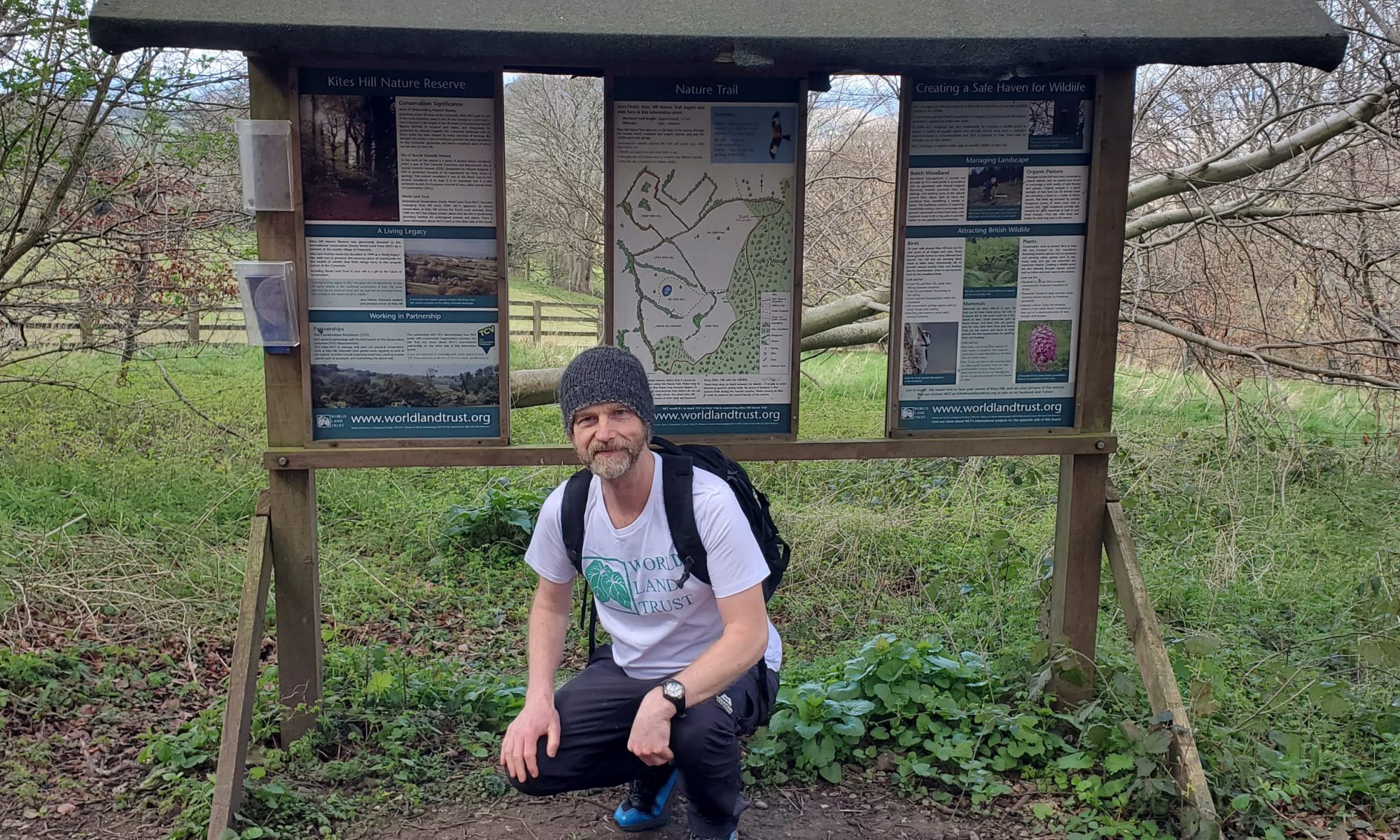
My stay with Clare and family had been brief but much appreciated. Suitably revived, it was time to head back on the trail. Clare had even made me a packed lunch. Again, it was nice to be looked after. We all headed out to the end of the back garden where I was shown a shortcut that would take me directly to the Clyde Walkway. After hugs and handshakes, I was off.

The Clyde Walkway was definitely a trail of two halves. For a number of reasons, I hadn’t enjoyed yesterday at all but today was different. Definitely more of a sense of being in the countryside with the trail mainly sticking to the side of the river but passing through woodland complete with wide tree-lined avenues and dappled light breaking though the canopy. I even saw a kingfisher darting across the river. It was all very lovely in a gentle kind of way. At one point the route passes the birthplace of David Livingstone and I had thought of stopping for a cheesy photo opportunity. Adam the intrepid explorer. I probably would have done had I found a suitable signpost to stand by.

I am not exactly sure why I decided I wanted to complete the walkway today. Because it was do-able? Because it kept the momentum going? Because I was stubborn and liked a challenge? Because there were no convenient campsites on route so I may as well keep going? Probably all the above. After a slight unintentional detour around the edge of Lanark, I finally reached New Lanark at around 7.30. It is a strange and beautiful place. A World Heritage site apparently. I’m not big on history but by the sounds of it, David Dale the original founder was a decent mill owner who built the village to house and otherwise support the wellbeing of his workers. Now there’s a thing. All the stone buildings looked picture-perfect, making me wonder what it was like to live there. I’d imagine there were a few rules. As there was nowhere open, I carried on the climb towards the Falls of Clyde. While there were one or two vantage points of the river where the water cascaded down rocks, there was no dramatic Niagara Falls style vista. Though to be fair, the light was starting to fade. It was all very pleasant although by now I was perhaps starting to get pre-occupied with where I was going to camp. Further still along the river I reached Bonnington Weir and simply on the basis that the waymarkers now had arrows just pointing one way rather than both ways, I decided that this must be the end of the walkway. It would do. Again I found it really strange that the authorities don’t make a big deal of it. THIS IS THE START/END OF THE CLYDE WALKWAY!!! Move on, Adam. After walking a few hundred yards I spotted a couple pitching a tent in a field by the river. I went over to have a word and after a discussion as to whether it was okay to camp there, I decided to go for it as well. Maybe safety in numbers was at the back of my mind. At the front of my mind was how gobsmackingly gorgeous the place was. The sun was setting, the Clyde just seemed to be drifting slowly by, and I had a Chili con carne to eat. This was why people wild camped. It was absolutely idyllic. I gave the couple a fair bit of space and even managed to find a gorse bush to hide me from the road.

At one point as I was lying in my tent, I heard a vehicle full of (what sounded like) drunken lads making a lot of noise. I did think it could easily all get a bit messy but thankfully they just drove off. This is why I don’t wild camp.

Day 22. New Lanark to Abington

New Lanark to Annan Water Day 1.
Distance today: 16.9 miles.
Total distance: 435.1 miles.
Accommodation: campsite.

No angry farmers, no curious animals. I’d survived another night in the wild. There was however a fisherman slowly working his way up river. Eventually he climbed out onto the bank near me and we had a chat as I packed up my gear. “Didn’t you hear me?”, he asked. Apparently he’d got there at about quarter to five and had been fishing quite close when there were 2 deer in between me and the other tent. I’d heard nothing, in spite of me thinking I’d had a restless night. He reckoned this was a popular spot with campers, particularly ‘kids’ who went there to indulge in their drug of choice. I don’t think he was a fan of the youngsters who had a tendency to get quite stroppy when confronted, not to mention leaving the place in a state. I guess I was just glad I didn’t have to deal with them last night.

Today’s route took me mainly along country roads. It was the first time that I wasn’t following (or at least trying to follow) an official trail. I was actually using the route that Adam Dawson walked when he did the LEJOG in 2014. One of my lasting memories was how ‘clean’ everything looked. Away from the dirt and the grime of the big, bad cities there was a crispness to the landscape. No plastic bags, no takeaway boxes, no empty cans of drink. It was as if they’d just had a massive tidy-up ahead of a royal visit.

Something else was preoccupying me as well. Meat. More specifically, our ability to disassociate meat with the creatures it came from. Throughout the trip I had passed field after field full of sheep. I challenge anyone not to smile when they see a frolicking lamb do its trademark four-legged leap. And I’ve just learnt a new word. Apparently this is called stotting. And yet, I do like a lamb roast dinner. When we see this happy, carefree little animal, how do we then say I want that on my plate. It feels hard to justify. What do they call it – cognitive dissonance?

At some point, Adam’s route seemed to go off piste. First it went from a road to a forestry track. Then it just seemed to take a beeline over a hill. I sensed I was going roughly in the direction I needed but it was nice to be reassured once I reached the brow and could see another road in the distance. Around about this time I started to see lots of cars and campervans parked up and, more strangely, quite a few people with large rucksacks making their way up hill. It seemed a very random place to warrant this much interest. The mystery was solved when I finally asked somebody passing. This was a well-known paragliding spot as used by the Lanarkshire and Lothian Soaring Club. After a couple more conversations I was temporarily better informed about how it all worked and sure enough, brightly coloured chutes soon started to appear in the sky. As ever, it was all a nice distraction from the job at hand.

After a couple more road miles I reached the village of Roberton. While there I got chatting to an older Scottish woman called Heather. She was on her way to a plant sale at the village hall. Sometimes when I talk about what I am doing, I do have the horrible feeling that I am making it into a sales pitch. Of course I want people to donate but I don’t want them to feel pressured. At the end of our conversation, Heather did kindly give me £10 for the cause. It does always feel like a boost, in many ways.

Theoretically, my stopping place for the night was going to be the campsite at Abington. Unfortunately, between there and Roberton there was a main road which meant hopping off and on the verge every time there was oncoming traffic. I can tell you, this gets boring very quickly. I’m sure Adam’s route was meant to take you along a quiet track but I could not find it.

Abington was doing its best impression of a one horse town. Peering into the windows of the hotel, there was no sign of life and so I didn’t rate my chances of getting a pub meal later. Across the road was the general store which at least had enough snacks to keep me going. The campsite was a few hundred yards away on the other side of the railway line. With no obvious walking trails in the vicinity, I wasn’t surprised to find that the site was mainly set up for caravans and campervans. While not going quite as far as saying “walkers not welcome”, the old woman who booked me in exuded indifference. The place where I was supposed to pitch my tent was the central area in the middle of all the caravans and quite clearly the one spot where kids would choose to kick a football around. I managed to find somewhere off to the side which also had a little shade. Did I mention that it had been quite warm for most of the day?

After one more visit to the general store for emergency beer, that was me pretty much done for the day. Predictably the noise levels did remain ‘raised’ until later in the evening when the kids finally headed back to annoy their parents instead.

Day 23. Abington to Moffat

New Lanark to Annan Water Day 2.
Distance today: 20.8 miles.
Total distance: 455.9 miles.
Accommodation: campsite.

Health update: I have niggles. As many people know, the symptoms are typically mild but in rare cases, it can lead to a debilitating condition. It’s my knees mainly. There’s just an occasional stabbing pain if my foot lands at a different angle. The obvious question being: is this something I should be worried about or can I just walk it off? Stay tuned, health fans. One thing I can say categorically is that my knees would be in far worse shape if I wasn’t using trekking poles. What an amazing revelation they have been.

There were a lot of road miles today. Fortunately for the most part, if it wasn’t a traffic-free road, it was a generous strip of tarmac next to the road. One long section seemed to be an access road which ran parallel to the very busy A74. It felt odd to be that close to such a volume of traffic but it was easy miles. I was still following the route provided by the other Adam and at a certain point, it veered away from the A74 and went a bit cross country. Thankfully it did end up on a forestry road which felt like it was taking me in the right direction. I admit there was a degree of blind faith involved.

And so to my near-death experience. Once the forestry trail had joined the A701 I was back to hopping off and on the verge to avoid the oncoming traffic. On straight roads it seemed safer to stick to the right hand side because you could spot vehicles coming from a distance without having to look behind you. When one car had passed me I instinctively stepped back onto the road because it was much easier to walk there. What I hadn’t anticipated – or bothered to check – was that someone coming from the opposite direction would choose the same moment to overtake. They missed me by a whisker. Holy shit, that was close. I was properly shaken up. Of course I wanted to put all the blame on the driver. They were definitely on the receiving end of a stream of expletives as they disappeared into the distance. Had they not seen me?! I am sure they could have delayed the manoeuvre until they were safely past me but of the two of us, I think I had probably been the more reckless. Lesson learnt.

At around about the viewpoint for the bizarrely named Devil’s Beeftub, I saw a waymarker for the Annandale Way. I thought I joined it further on but I was more than happy to leave the road and follow what turned out to be a well-signposted, well-trodden trail all the way to Moffat.

My first impressions of Moffat was that it looked inviting enough in a touristy kind of a way. Plenty of pubs anyway. After a much appreciated pint in the Stag Hostel I made my way across town to the Moffat Camping and Caravanning Club Site. No surprises, it might have camping in its name but it was all about campervans and caravans. I counted 5 people on duty, all wearing official club polo shirts. It did seem a bit over the top but I wondered whether there was a requirement to volunteer as part of the membership rules. A bit like yesterday, the area for pitching tents was also one of the main thoroughfares but the site was big enough so it was fine.

Out in the evening to find something to eat but I’d left it a bit late. I tried the lounge bar of the Famous Star Hotel but as all the tables were full they wouldn’t even let me stay for a beer. Instead they sent me around the back to the Star Bar which was basically a divey sports bar. I didn’t fancy any of the bar snacks but I stayed for a pint, listening to lots of sweary locals laughing at a coughing local who sounded like he had smoked way too many cigarettes.

Day 24. Day off

Another day off? Call yourself a dedicated walker? Apart from the aforementioned niggles, I’m not sure I really needed a rest day but if I was going to have one, Moffat was as good a place as any. Hopefully my body will thank me. With birthdays and a significant anniversary coming up, I scoured the town for appropriate gifts. No joy. By way of compensation, I did at least find a place to get a breakfast fry-up. Mutchies Munchies, if anyone happens to be passing through.

Back at the campsite you could feel the electricity in the air as staff got ready for their very own street party to celebrate the jubilee. Bunting, paper plates, fold-up chairs, the whole works. I wasn’t quite sure why today but I have never knowingly turned down the offer of cake.

I ventured out into town again and discovered 2 shops I’d missed the first time round. The co-op is always a good place to stock up. I’m less sure about Moffat Mill (aka emporium of tat). I don’t know why but I do have a strange fascination with these kind of places. Whatever I might think about the stuff, someone, somewhere has decided there is a customer for it.

A chippy dinner and that was me done for the day.

Day 25. Moffat to Lochmaben

Annandale Way Day 1.
Distance today: 21.9 miles.
Total distance: 477.8 miles.
Accommodation: campsite.

Happy birthday Sian.

Another pleasant day in the countryside. Not too much to get excited about which is a shame because the Annandale Way definitely wins the award for the best signposted trail I have been on this trip. I did see a hare so that was exciting as I can’t remember ever seeing one before.

There was a lovely moment in the afternoon when I was walking down a country track which threaded its way through some farm land. Someone had fixed in place a couple of plastic moulded chairs to allow anyone passing to take a moment to admire the view. According to the name plate, this was “No No’s Seat”. Protected from the elements inside a wooden box was a visitors book for people to be able to leave a message. It was the least I could do. It reminded me of a place on the Cotswold Way where someone had a tap outside their house with a sign saying help yourself. It’s nice to be nice.

My stopping point for the day was the Kirk Loch Caravan And Camping Site in Lochmaben. Maybe I should have taken heed of the omens just before I arrived. Having been fine for most of the day, it absolutely hammered down as I wandered around Lochmaben trying to find the campsite. Even though it is fairly central, it is tucked away and as the name suggests, situated right next to Kirk Loch. The loch itself is small but pretty enough in spite of being almost entirely surrounded by a golf course. With no one on site, there was a number to ring and I was duly told the key code for the toilet block and where I was supposed to pitch. This is when the alarm bells started ringing. While the caravans and campervans had a fairly well defined perimeter to park within, those of us with tents shared a patch of grass with the local playground. Essentially I was paying £15.50 to wild camp in town without any sense of security whatsoever. Not happy.

With my tent pitched, I went for another wander around town. The high street was not what you might call bustling but I did find a chemist. I’m not sure when it happened but I seemed to have picked up a couple of insect bites on my knee and they were starting to look inflamed. Hopefully the ointments I purchased will keep things contained.

To be fair to the campsite, the showers were very good. Lots of really hot water so I cannot fault them for that. Just everything else. Suitably de-grimed, I headed out to the nearby Crown Hotel hoping to get something to eat. Sorry, the chef’s off. Oh well, just a pint it is then.

Back in my tent, I was busily sorting my things out when I started to hear some noises outside. A group of lads were walking by, inevitably being a bit loud and boisterous. I could hear the sound of a spray can being rattled and the next thing I knew, something had been banged against the side of my tent. “What the fuck!”. I’m not sure they expected anyone to be inside and so when I got out to check what was going on, they were already running off. At the end of the day they were just bored kids messing about but it was still pretty unnerving. I have no doubt my tent was close to getting an artistic makeover. My money would have been on something anatomical or simply the word “wanker”. I was left wondering whether they were done or were they going to come back later?

Day 26. Lochmaben to Annan

Annandale Way Day 2.
Distance today: 21.9 miles.
Total distance: 499.8 miles.
Accommodation: campsite.

The second day of the Annandale Way and I think there was a bit more landscape diversity compared to yesterday. Loch-side, river-side, road-side, hillside and forestry, in no particular order. For anyone interested, this is a good day to compare my pre-planned route with where I actually walked to see just how many times I managed to veer off track.

The first annoying moment of the day happened somewhere near Rammerscales Georgian mansion. A grand looking building which I only saw in passing but will be remembered as the nearest landmark to where I lost my precious merino wool beanie. Here’s the thing. My waterproof jacket doesn’t have pockets and so when I was on the move and my head got too hot, I would stuff the beanie inside my jacket to save me having to stop and put it somewhere sensible. Consequently, when I do stop and unzip my jacket, unless I am paying attention, it’s very easy for the beanie to drop to the floor without me noticing. So yes, just my own stupidity to blame.

The trail just past Rammerscales takes you along a very muddy and hilly forestry access road and continuing the theme of me not paying attention, I missed one of the waymarkers. It was only when I’d got to the bottom of a particularly muddy hill that I guessed I was going in the wrong direction. Backtracking I then struggled to work out which of the various roads on offer was the one I had walked down. It was all just trees and mud. After finally finding the missed turning, I escaped the claustrophobia of the forest and was a happier man as I made my way out onto the open moorland. Just me, the hills, a few long-since deserted buildings, and a lot of sheep.

After stopping to admire the lovely panoramic views from the top of the Almagill Hill (home to Joe Graham’s Monument), it was time to thread my way slowly down to the River Annan. It took a while. I guess there are always good reasons why a route insists on taking you a long-winded way but at the time, it’s difficult to see what those reasons are. You can see a direct line to where (you think) you need to go but the route inevitably takes you a different way. Maybe it is just the deal that has been struck with the landowners.

Time for some more incompetence. When I got down to the B7020 near Dalton, I couldn’t work out which direction to go. Left took me back towards Lochmaben and that definitely felt wrong. Right took me through Dalton with no obvious trail that could get me off the road. The waymarkers were telling me to go left but it just didn’t make any sense so I went right. I should have gone left. Added to which (and not helping my decision making) my phone was running on empty. When I got to Dalton, I saw a woman outside her house and cheekily asked if there was any chance I could charge my phone. Happily she agreed and led me through to the conservatory. What’s more, she asked the magic question: “would you like a cup of tea?”. Perfect. I think her name was Julie and she lived there with her husband David who came and joined the conversation. By all accounts, Sir Ian Botham had passed this way on both the occasions he walked from John o’ Groats to Land’s End. David reckoned the most famous walking cricketer had waved to him both times. Something tells me I am not going to raise quite the same amount of money.

Back on the road and after a couple of miles I reached Hoddom, the place where I rejoined the official trail. From here it was riverside path all the way to Annan.

Annan seemed a bit … underwhelming. A place that looked like it had seen better days. At first glance, the Galabank Caravan and Camping site followed suit. There was no one in charge on site and the facilities were fairly basic but, as is becoming my motto, it would do. The woman who ran the place eventually turned up and charged me the princely sum of £5. I pitched my tent next to a guy called Mark who was travelling on his own this time because his wife didn’t fancy it. He was the proud owner of a Fifer campervan which amongst other things had power sockets. Cue the second occasion today for me to ask if I could charge my phone. Not only did he agree to let me do that but he also gave me a £10 donation and, much more importantly at that precise moment in time, a cold Morreti from the fridge. What a star.

Day 27. Annan to Metal Bridge

Annan to Carlisle Day 1.
Distance today: 15.4 miles.
Total distance: 515.2 miles.
Accommodation: campsite.

Today was the first time my route took me almost exclusively along normal roads. With traffic. The Channel of River Esk has a lot to answer for. It was the annoyingly big obstacle blocking my way south. There didn’t seem to be too many alternative options unless I was prepared to walk a lot further. Anyway, first stop: the big Tesco superstore on the edge of town to stock up on snacks.

Walking beside main roads is obviously boring but fine so long as any surrounding houses are treated as part of a bigger whole that needs to be linked by pavements. As soon as the houses end, the pavement ends and it’s back to the ol’ favourite of hopping off and on the verge. Occasionally I’d see a blue sign indicating that a route was part of the National Cycle Network and generally, if the map confirmed it was heading in roughly the right direction, it was worth following as it was likely to be a quieter road.

When I reached the village of Eastriggs, I stopped at the Green Café to treat myself to a mid morning coffee but couldn’t resist getting a bacon bap as well. As the only customer, I chatted with the 2 women working there and when it came time to pay, they wouldn’t let me. It was their contribution, they said. Aww. It is really nice when something like that happens.

Also in Eastriggs was the intriguingly named The Devil’s Porridge Museum. The eponymous porridge refers to the highly explosive combination of gun cotton and nitroglycerine that workers in the local munitions factory had to mix by hand during World War 1. I think that was all I wanted to know so I didn’t actually bother going to the museum. Although, pop fact: it was Sir Arthur Conan Doyle who came up with the name.

Next stop Gretna Green. Historically known for the blacksmiths which served as a cross-border venue for runaway marriages, I couldn’t swear that I’d ever been there before but for some reason, as with the Glenmorangie Distillery, it felt like a necessary pilgrimage. Something about the name resonated with my childhood. It could be the souvenir brass anvil that had been a fixture in the family collection of ornaments for as long as I could remember. It could even be that when I was very young we used to live in Grafty Green and I was simply mixing up the two places. Whatever the reason, I felt obliged to pay a visit. As is the way these days, what starts off life as a quirky tradition eventually ends up becoming a soulless tourist trap. They had a café, a shop with staff in twee tartan outfits, and even a lone piper playing near the outside seating area. Alas, no souvenir anvils. Judging by the quizzical expressions on their faces, I got the impression the staff couldn’t remember a time when they did sell them. Taste moves on. If you’re desperate, you can pick one up on eBay for less than a fiver.

About a mile and half away from Gretna Green was a small but significant sign. “Welcome to England”. That is a proper milestone. A bona fide moment. Somehow, I had managed to walk through Scotland in 27 days. I can understand how that might sound like I am boasting but in truth, I am just genuinely amazed – and grateful – that I have been able to do it. Similar to the feeling when I reached Inverness, it was something tangible to bank. As if to say, if it all went wrong now, at least I’d got this far. So yes, I was chuffed.

The next big landmark on route was Carlisle but it was still a fair hike away and it didn’t seem to offer much in the way of camping. A little bit closer was the ‘small settlement’ (thank you, Wikipedia) of Metal Bridge which pretty much consisted of a pub and the Metal Bridge House Camper Stop/Aire. Both owned by the same people. Strictly speaking, the camper stop did not allow tent pitches but when I phoned the woman in charge, I pleaded my best I’m-doing-this-epic-walk-for-charity case until she finally relented and said I could I pitch in the garden of the nearby house which they also owned. Having free accommodation was always appreciated but not having to think about where I was going to sleep was just as valuable.

I arrived at Metal Bridge at around 4 o’ clock and one of the first things you notice is the background noise. With a motorway on one side and a train line on the other, this was not going to be a quiet night. It would do. Once I’d pitched my tent I thought I’d have a celebratory pint in the pub but the doors were locked and, more worryingly, there was little sign of life. Maybe it was too early. I had a wander around the area and confirmed there wasn’t much to do or see there. Even the nearby stretch of the Channel of River Esk looked a bit ordinary, bookended as it was by two characterless bridges.

Happily, the pub did open in the evening. It might call itself an Inn but it struck me as being more of a restaurant. There was a small waiting area if you were just there for a beer whereas if you were eating then they allocated you a table. The time had come. I was going to have a lamb roast. And after all the anticipation, it was very disappointing. The apple crumble and custard was better. Given the generosity of letting me pitch for free, there was something strangely detached and dare I say unwelcoming about the staff. Efficiency seemed to be the main thing they were striving for. Judging by various reviews I have read since, they are known to be hospitable, so perhaps I had just caught them on an off day.

Day 28. Metal Bridge to Caldbeck

Annan to Carlisle Day 2 & Cumbria Way Day 1.
Distance today: 24.6 miles.
Total distance: 539.8 miles.
Accommodation: campsite.

With no obvious alternatives to walking along the main road, my first task was to get to Carlisle before the traffic woke up. A combination of being on the road by 7am and picking up the pace a bit meant the experience wasn’t as painful as it could have been. There were even those magic things called pavements as I got closer to the city.

I was beginning to realize that power was a problem. Some people had too much. I didn’t have enough. I had a power block that met my needs for 5 to 6 days when fully charged, the trouble being it took all night to charge and campsites weren’t the ideal environment to facilitate this. The next best thing was finding places to charge my phone. Step forward Waterstones. I spent an hour or so nursing pots of tea and Moma porridge while my phone was quietly being resuscitated under the table.

I didn’t hang around much longer in Carlisle – just long enough to get a map of the Cumbria way and a replacement beanie. Yes, for £4 at a bargain basement version of the Edinburgh Woollen Mill I got a lime green acrylic beanie. Better than nothing.

As ever, trying to follow a trail out of town proved tricky. Please, someone, give us a sign. In fact, more than one sign. Once the trail reached the countryside, it turned out to be really lovely. The paths were nice and clear, the sun was shining, and everything just seemed to look vibrant. It was a genuine pleasure walking the land.

My stopping place for the night was Caldbeck Camping which was conveniently on the trail just before you got to Caldbeck. And it was also lovely. I guess you’d call it a farm campsite. The woman who ran the place happened to be there when I arrived and she pointed out a place to pitch, saying that’s where she recommended walkers to go to avoid the slightly noisier (drinking) section at the other end of the site. She also opened up a store room so that I could charge my phone. And the bonus? The price for the pitch was just a fiver. It all just came across as a generosity of spirit and was much appreciated by this weary traveller.

In the evening, I wandered into the village and after a good look round, I treated myself to a pint and some food at the Oddfellows Arms. It took a lot of willpower to stick to just the one pint.

Day 29. Caldbeck to Keswick

Cumbria Way Day 2.
Distance today: 22.1 miles.
Total distance: 561.9 miles.
Accommodation: campsite.

Speaking to the owner of the campsite, she said that all I needed to do to get to Keswick was to climb that hill, pointing to High Pike, and then it was pretty much all down hill from there. Easy-peasy. As is fairly obvious by looking at the map of my route, I didn’t start well as I struggled to find the right way out of the village. The next test was interpreting a signpost that was showing the way to Potts Gill. There were 2 alternative sections of the Cumbria Way before Keswick: the longer Western Alternative and the shorter but steeper Eastern Alternative. Looking at the map, I could see that both sections passed through 2 different places called Potts Gill. So which one was the sign pointing to?! Clearly it was all designed just to wind me up. I followed the sign anyway and the answer turned out to be both because the route hadn’t split yet. Now it makes sense.

There’s no denying that the accumulation of navigating frustrations would occasionally get to me. I don’t think it helped that it didn’t take much for me to channel my inner grumpy bollox. If my own mistakes caused me to go the wrong way then I’d give myself a hard time because I think I should have done better. If it was down to bad signage then I think someone else should have done better. In the heat of the moment it was easy to forget there were usually mitigating circumstances. There was the small matter of me never having done anything like this before. My only previous solo ‘multi-day’ hike was the 2 days I spent finishing off the Cotswold Way. Walking 20+ miles day after day, things were bound to happen and mistakes were going to be made. I do regret not honing my map-reading skills before I embarked on this trip but there wasn’t much I could do about that now. As for the waymarkers, I’m guessing most trails relied on underfunded volunteers who were doing the best they could.

There was also the question of what kind of challenge I wanted. Was the physical challenge of getting from John o’ Groats to Land’s End enough? If someone could take care of all the decision-making would I sign up? No, I absolutely would not. 2 words that send a shiver down my spine: organized tour. For me there was something deeply satisfying about solving a problem whether that was by using the maps you had to hand or simply by trusting your gut. And for that satisfaction, I was more than prepared to live with the occasional moment of sweary frustration.

Having opted for the Eastern Alternative and played another game of guess-the-right-unmarked-track, I made it to the top of High Pike and once again found an escape valve for most of my frustration. I am here to say: I love the Lake District. What is it about the landscape that seems to make it unique? I have only been here a few times and it just has its own brand of beauty. There is something about the colours. And the fact that in spite of the drama of the surrounding mountains, very little about the landscape feels threatening. It is undeniably a very special place. It is also one of the reasons I chose this more western route through England rather than the more classic option which takes in the Pennine Way.

And then I got lost again.

I bumped into a woman who had an OS map and she reckoned I would see the Lingy Hut as soon as I got over the brow of the next hill. I didn’t. I carried on in what felt like the right direction and didn’t come across a single clue. Definitely no waymarkers. Eventually, I spotted a road in the valley below and I made a beeline for it. It was actually near a point where the road forked which meant I now had 3 choices. I chose wrong again. I really am not very good at this. I used to pride myself on my intuitive onboard compass but it appears to be broken. In hindsight I cannot understand why I chose the direction I did, other than the fact it was the only one going down hill. The further I walked, the more landmarks I found that could confirm I was going the wrong way but rather than retrace my steps, I stubbornly carried on. When I got to Mosedale, I was seriously tempted to scrap the idea of going to Keswick. I had veered so far east I wondered whether it would be quicker to find a more direct route towards Ambleside and beyond. In the end I decided it was easier to stick to the plan.

Apart from a small section walking next to the A66, the route from Mosedale to Keswick was mainly along quiet country lanes. As habitual as it was to beat myself up over the various wrong decisions, I couldn’t help smiling about the thought that of all places to get lost in, I could do a lot worse than the Lake District.

Do I mention this? Yes, I am going to mention it now because I didn’t at the time. While I was walking, I passed a couple and their young son, sitting down having a picnic on a small embankment by the side of the road. As casually as you like, the man tossed a banana skin behind him. Given the setting and the example he was giving to his son, it just felt wrong. But was it my place to tell him this? Not this time. Walk on by.

And so to the metropolis of Keswick. Significant to me – and one of the main reasons why I persevered in going there – was the fact it had a hospital. Health update: my insect bites were not getting any smaller and all the surrounding area was looking quite inflamed. The Mary Hewetson Cottage Hospital was on the far side of town and everything from it being late Saturday afternoon through to the NHS being systematically run down told me that I was in for a long wait in A&E. You can imagine my surprise when I walked in and found the place completely empty. Not a single person waiting. How is that possible? The doctor saw me straight away and with our extensive combined experience we both reluctantly agreed I needed anti biotics. We chatted about my trip and after apologizing that she didn’t have any money on her to donate, she then scoured the hospital to find me the anti-biotics. It was getting close to 5pm and the chances were I would otherwise have to wait until the chemists opened tomorrow. She also gave me some dressings in case the bites started weeping. I felt a lot better just knowing I should now have what I needed to make things better. God bless the NHS.

The town had 2 campsites pretty much next to each other and I picked The Keswick Camping and Caravanning Club site which was right next to the beautiful Derwentwater. I pitched fairly close to the lake, thinking I would have a lovely view of the sunset from my tent, not realizing that everyone would bring their chairs and drinks down there to enjoy the atmosphere as well. Thankfully they didn’t stay too late. Meanwhile, a couple of hundred yards away, there was a beer festival going on in a huge marquee. A covers band was providing the entertainment and to be fair to them, they had the crowd singing along to most of the songs. No beer for me, but I did have a very tasty macaroni cheese.

Day 30. Keswick to Great Langdale

Cumbria Way Day 3.
Distance today: 19.2 miles.
Total distance: 581.1 miles.
Accommodation: campsite.

The plan today was get to Chapel Stile. This was as far along the Cumbria Way as I intended to go since the rest of the trail took you south towards Ulverston and I needed to go further east. In spite it being Sunday I guessed that Wetherspoons would be open early enough for me to have a quick breakfast and charge my phone. Sure enough they opened their doors at 8 o’ clock and I joined 10 or more bleary-eyed men who had been waiting to get in. They had the look of post-stag do or perhaps post-beer festival.

After the usual problems of finding my way out of town, I joined the trail as it skirted the west side of Derwentwater. For the next few miles, it was a lovely gentle walk with enough changes in scenery to keep it interesting. Streams and rivers, woodland and open moorland all contributed. Let’s face it, it’s an established trail in the middle of the Lake District – it was never going to be dull.

After Stonethwaite, the route gradually ascended as it made its way up to Stake Pass. You essentially follow the course of a river and on the advice of someone I passed, I chose the right side as it was meant to be easier. At some point I realized I needed to be on the left side and was stupidly smug when with some strategic stepping stones I managed to find a place to cross without resorting to taking boots and socks off. Had I kept my nerve and stayed on the right, there was actually a bridge further up. It was hard not to be overawed by the landscape. Walking along the valley floor it felt like I was in a massive mountain-sided amphitheatre. The trees had mostly gone, leaving the beautiful desolation of the fells. I can generally tell how much I love a landscape by how many photos I take and I took a lot. Breathtaking.

The route out of the amphitheatre was a steep zig-zag climb alongside a series of cascades. It was at this point that I started to feel ill. I had the sensation of wanting to vomit but not being able to. My timing couldn’t have been any better. There was no other person around, I was on an exposed mountainside, I had no phone signal, and it looked like the weather was starting to turn. I had no idea why I was feeling so bad. Was it heat stroke? General exhaustion? Dehydration? And then I had a thought. Did the anti-biotics have any side effects? Low and behold, when I read the leaflet that came with them, it warned that one in ten people felt sick during the first couple of days. There we go. Somehow it made me feel a little better.

Theoretically when I’d reached the brow of the hill it should have been downhill from there. Sound familiar? Once again I managed to miss the turning and while not on the scale of the Great Glen Way Misadventure, I was definitely going up instead of down. Not having learned my lesson from the GGWM, I just carried on going, hoping to see a route down after I reached the next brow. It took a few brows. When I finally got to see the valley, it was a long way down and even though I could see the beginning of a path, it looked quite precarious and very skinny. Not necessarily something you would choose to take on carrying a big rucksack while it’s blowing a gale. Sketchy is the word I’d use. Thankfully, the sketchiness didn’t last because at some point the path turned into a series of steep steps. As grateful as I was for a safer path down, I was struggling to understand that people could dedicate the time and effort to construct a whole mountainside of steps and yet not feel the need to add the occasional waymarker here and there. That is very odd.

As I was heading down the mountain I could see the Great Langdale Campsite below. Reception closed at 7pm and I made it with 3 minutes to spare. I’m not sure if it was all down to the anti-biotics but I was a broken man. Completely exhausted. I summoned up enough energy to pitch my tent, have a shower, and put some things in the drying room but that was it. I’d bought a beer at reception but barely had a mouthful before deciding it probably wasn’t a good idea. Things have to be bad if I am wasting beer.